Tag Archives: Horseshoe Bend

More Time With Friends — Lake Powell & Grand Canyon North Rim; October 17-27, 2017

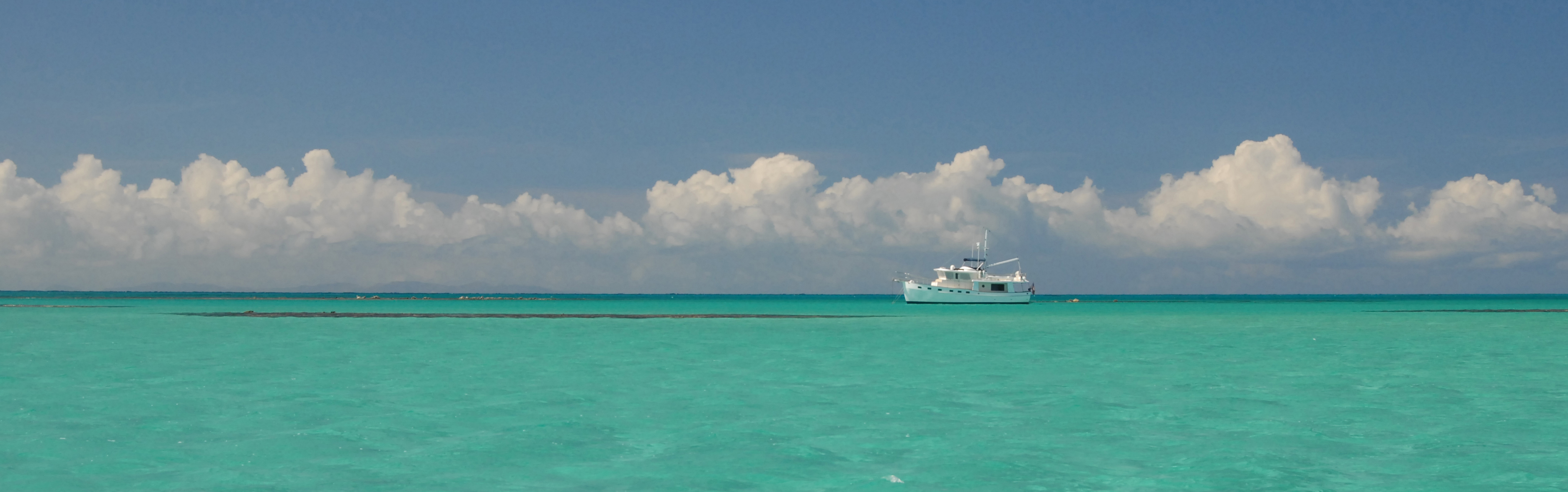
The gang of six got settled into the Wahweap RV & Campground on October 17, and took the pontoon boat out onto Lake Powell the next day.  The day was mostly sunny, but fairly cool.  Our destination was Rainbow Bridge.

From Wikipedia:

A natural arch, or natural bridge is a natural rock formation where an arch has formed with an opening underneath. Natural arches are formed from narrow fins composed of sandstone or limestone with steep, often vertical, cliff faces. The formations become narrower due to erosion over geologic time scales. The softer rock stratum erodes away creating rock shelters, or alcoves, on opposite sides of the formation beneath the relatively harder caprock, above it. The alcoves erode further into the formation eventually meeting underneath the harder caprock layer, thus creating an arch.  The caprock itself continues to erode after an arch has formed, which will ultimately lead to collapse. The Natural Arch and Bridge Society identifies a bridge as a subtype of arch that is primarily water-formed.  [Indeed.  Bill & Colleen report that a number of years ago they were able to boat all the way up to and directly under the bridge.  Today, because of receding lake depth, there is a significant hike from the Park wharf to the bridge.  CTS ]

Rainbow Bridge is often described as the world’s highest natural bridge. The span of Rainbow Bridge was reported in 1974 to be 275 feet, but a laser measurement in 2007 has resulted in a span of 234 feet. At the top it is 42 feet thick and 33 feet wide. The bridge, which is of cultural importance to a number of area Native American tribes, has been designated a Traditional Cultural Property by the National Park Service.

Rainbow Bridge is one of the most accessible of the large arches of the world. It can be reached by a three-hour boat ride on Lake Powell [which is what we did] followed by a mile-long walk [not really that long] from the National Park wharf in Bridge Canyon, or by hiking several days overland from a trailhead on the south side of Lake Powell (obtain a permit from the Navajo Nation in Window Rock, Arizona).

 
The weather not looking favorable on October 19, we took a day off from boating and instead drove up to the Northern Rim of Grand Canyon.  The weather wasn’t perfect for that either, since the mostly cloudy skies provided sub-optimal illumination for the colorful canyon sides.  But then, just as we were on our way back to our vehicle as the sun approached the horizon, the sun broke through for a few precious moments.  Joan and I quickly grabbed a few consolation shots.

On October 20 we returned to the Lake despite a rather grim forecast of high winds later in the day. We told ourselves that we weren’t going far and that we would be protected by the cliffs to the west, since we planned to go south to the Glen Canyon Dam. On our way, we lallygagged at the marina, spending time looking at the huge pontoon boats moored and docked there, and perusing the gift and nautical shop. When we arrived in the vicinity of the dam, we had a leisurely snack of cheese, crackers, grapes and margaritas. And then the wind hit. We soon discovered that the winds were coming from the direction in which we needed to travel in order to get back to our launch ramp, and that the wind-swept waves were hitting the front of the boat and splashing up onto we hapless passengers. To make matters worse, the wind began to threaten to rip the canvas bimini, and so we had to stop and disassemble that. When we reached the launch ramp, we realized that the wind and waves at that site were broadside, rendering impossible getting the boat back onto the trailer. So we retreated to another ramp that was more protected, moved the truck and trailer to our new ramp, and ultimately arrived safely back at our campground, albeit more than a little cold and wet.

While Barb stayed back to do some RV chores, the rest of us drove out to Horseshoe Bend, on the Colorado River about 4 miles southwest of Page. It is accessible via hiking a 1.5-mile round trip from U.S. Route 89, and can be viewed from the steep cliff above the river.  The distance from the overlook to the Colorado River below is about 1,000 feet.

On October 21 the brothers and their wives got up early and joined a guided visit to Antelope Canyon. Barb and I had been there the year before (see our blog coverage here), so Barb did some laundry while I worked on our overdue blogs. When they returned, Matt & Joan split off and headed northward toward Utah’s National Parks and the rest of us returned to Parks, where we spent a few days cleaning our RVs and getting ours ready to be tucked into an RV storage facility not far from Parks. Late in our preparations we realized that the Chevy Tracker could fit into our rented space as well if only it could be put in sideways in front of the RV. Bill had four stands on wheels, and so that is what we did. We had inches to spare.

On Our Own, Again — Page, AZ, August 29-September 1, 2016

Horseshoe Bend, one of the most photographed areas on the Colorado River, is located just north of Grand Canyon and outside Page, Arizona.

Antelope Canyon is a slot canyon located on Navajo land east of Page, Arizona. The Navajo name for Upper Antelope Canyon means “the place where water runs through rocks.”

Antelope Canyon was formed by erosion of Navajo Sandstone, primarily due to flash flooding and secondarily due to other sub-aerial processes. Rainwater, especially during monsoon season, runs into the extensive basin above the slot canyon sections, picking up speed and sand as it rushes into the narrow passageways. Over time the passageways eroded away, making the corridors deeper and smoothing hard edges in such a way as to form characteristic ‘flowing’ shapes in the rock.

Flooding in the canyon still occurs. A flood occurred on October 30, 2006, that lasted 36 hours, and caused the Tribal Park Authorities to close Lower Antelope Canyon for five months.

Antelope Canyon is a popular location for photographers and sightseers, and a source of tourism business for the Navajo Nation. Private tour companies have been permitted to offer tours since 1987. It has been accessible by tour only since 1997, when the Navajo Tribe made it a Navajo Tribal Park. Photography within the canyons is difficult due to the wide exposure range (often 10 EV or more) made by light reflecting off the canyon walls.  (My pictures within the canyon were made by taking multiple pictures at varying levels of exposure and then combining them using HDR (High Dynamic Range) software in Adobe Photoshop CS6.)

In the 1940s and early 1950s, the  U.S. Bureau of Reclamation planned to construct a series of Colorado River dams in the rugged Colorado Plateau province of Colorado, Utah, and Arizona. Glen Canyon Dam was born of a controversial damsite the Bureau selected in Echo Park, in what is now Dinosaur National Monument in Colorado. A small but politically effective group of objectors led by David Brower of the Sierra Club succeeded in defeating the Bureau’s bid, citing Echo Park’s natural and scenic qualities as too valuable to submerge. By agreeing to a relocated damsite near Lee’s Ferry between Glen and Grand Canyons, however, Brower did not realize what he had gambled away. At the time, Brower had not actually been to Glen Canyon. When he later saw Glen Canyon on a river trip, Brower discovered that it had the kind of scenic, cultural, and wilderness qualities often associated with America’s national parks. Over 80 side canyons in the colorful Navajo Sandstone contained clear streams, abundant wildlife, arches, natural bridges, and numerous Native American archeological sites. By then, however, it was too late to stop the Bureau from building Glen Canyon Dam.

Emboldened by Echo Park and desperate to protect the Grand Canyon from a similar fate as Glen, Brower and the Sierra Club directed attention towards the proposed Bridge and Marble dams. The Sierra Club launched an extensive publicity campaign to sway public opinion against the plan; in response to the USBR’s argument that new reservoirs would open up the Grand Canyon to recreational boaters as Lake Powell had, a full-page advertisement in the New York Times ran the slogan: “Should we also flood the Sistine Chapel so tourists can float nearer the ceiling?” Faced with a tremendous outcry, the Bureau abandoned its Grand Canyon dams, effectively terminating most of the Pacific Southwest Water Plan, in 1968. The coal-fired Navajo Generating Station was built near Page, to make up for the electric power that was lost with the cancellation of the dam project. The Sierra Club lost its IRS tax-exempt status a day after the advertisement was released; ostensibly, this was due to its disruptive political activities. However, the group’s membership more than doubled in the next three years, many of them citizens unhappy with the IRS’ action.

The Glen Canyon Bridge or Glen Canyon Dam Bridge is the steel arch bridge carrying U.S. Route 89 across the Colorado River. The bridge was originally built by the United States Bureau of Reclamation to facilitate transportation of materials for the Glen Canyon Dam, which lies adjacent to the bridge just 865 feet upstream. Carrying two lanes, the bridge rises over 700 feet above the river and was the highest arch bridge in the world at the time of its completion in 1959.

Lake Powell, straddling the border between Utah and Arizona, is the reservoir on the Colorado River created by Glen Canyon Dam. The reservoir is named for explorer John Wesley Powell, a one-armed American Civil War veteran who explored the river via three wooden boats in 1869. It is a major vacation spot that around 2 million people visit every year. It is the second largest man-made reservoir by maximum water capacity in the United States behind Lake Mead. However, due to high water withdrawals for human and agricultural consumption, and because of subsequent droughts in the area, Lake Powell is currently larger than Mead. The existence of the reservoir led to the creation of Glen Canyon National Recreation Area in 1972, a popular summer destination on public land managed by the National Park Service.

Lake Powell is a water storage facility for the Upper Basin states of the Colorado River Compact (Colorado, Utah, Wyoming, and New Mexico). The Compact specifies that the Upper Basin states are to provide a minimum annual flow of 7,500,000 acre feet to the Lower Basin states (Arizona, Nevada, and California).

Approximately 12 miles from Page, and 9 miles from Glen Canyon Dam, is an unusual campground:  Lone Rock Beach Primitive Camping, featuring camping on a sandy beach or in dunes with no designated campsites.  Open fires are permitted, but must be within a four foot squared area. There are 4 micro flush toilets, 6 vault toilets, 1 comfort station/wheelchair accessible, and an outdoor cold shower, There is an Off Road Vehicle area, a dump station, potable water (seasonal), and a day use area. No launch ramp. $14 per vehicle/per night. (But no charge to Golden Age Passport holders.)  No reservations.

The site is named for Lone Rock, a large isolated redrock formation.

[Facts in this post gleaned from several Wikipedia posts.  Opinions are those of this blog’s authors.]